
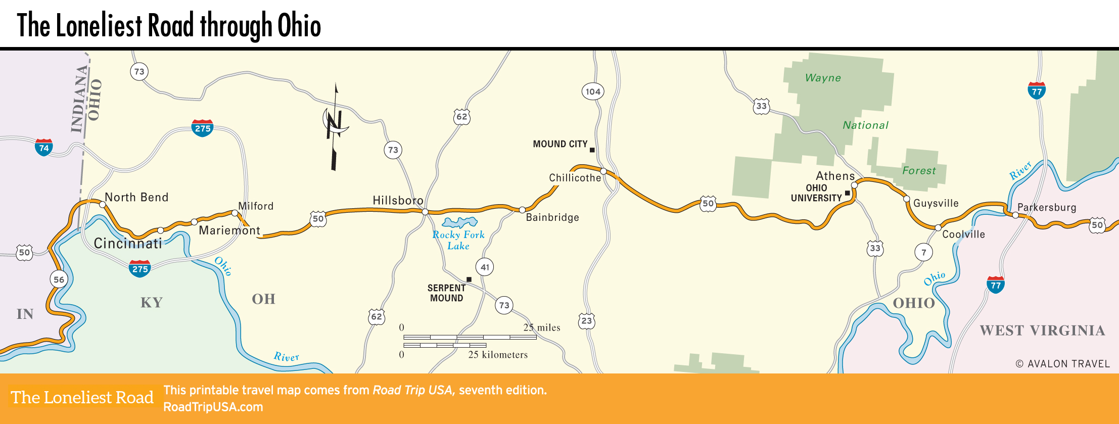
Winding along the Ohio River from Indiana, US-50 cuts east from Cincinnati across the hill-and-valley country of southern Ohio before finally crossing the Ohio River into West Virginia.
The 210 mi (340 km) US-50 takes to cross the state are a fairly constant mix of upland forest and bottomland farms, with a single industrial district in the middle around Chillicothe, and a refreshing small college town, Athens, farther east.
![[object Object]](https://content.roadtripusa.com/wp-content/uploads/2020/07/Michigan8_Final.jpg)
![[object Object]](https://content.roadtripusa.com/wp-content/uploads/2018/10/61EWPi1H0L.jpg)
![[object Object]](https://content.roadtripusa.com/wp-content/uploads/2021/03/9781640499904-1.webp)