
Nevada
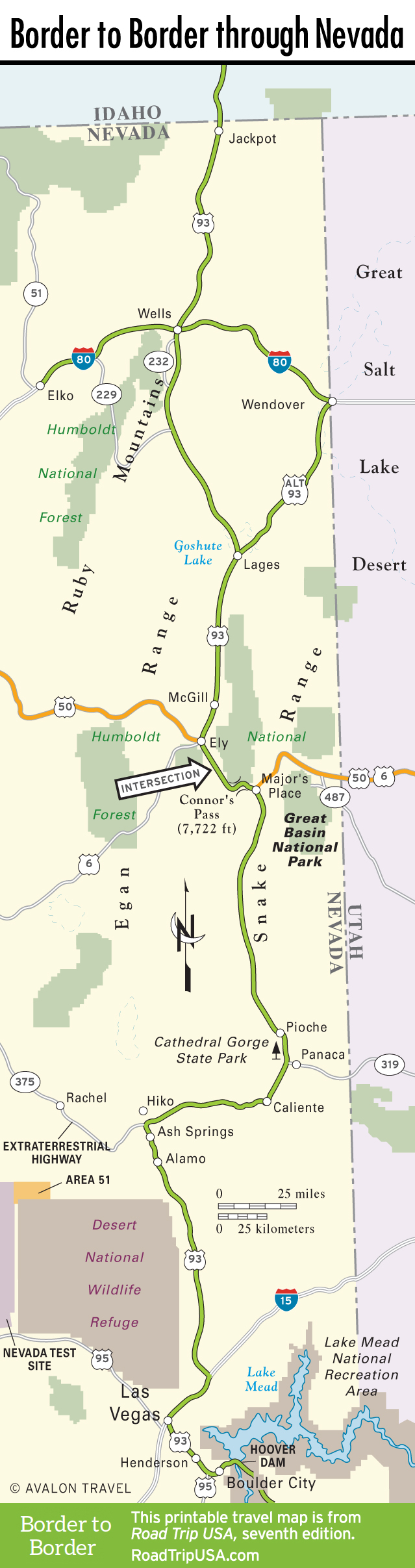
US-93 runs south along the eastern edge of Nevada for 520 miles, 500 of which take you through an exceptional degree of desolation—endless straight and narrow valleys, two-car traffic jams, and towns few and far between.
From the gambling oasis of Jackpot on the Idaho border to where the highway crosses into Arizona atop Hoover Dam, US-93 is at least as lonely as its Nevada sibling US-50, the official Loneliest Road in America. Towns like Wells, along I-80 in the northern half of the state, are big events; south of here it’s 140 miles to the next watering hole, Ely, beyond which the old mining camp of Pioche and the desert hot springs resort of Caliente are the only wide spots in the road before you hit the staggering city of Las Vegas.
Travel Map of the Border to Border Route through Nevada
![[object Object]](https://content.roadtripusa.com/wp-content/uploads/2021/07/Moon-Utah-9798886470147-Jacket.jpeg)
![[object Object]](https://content.roadtripusa.com/wp-content/uploads/2020/09/TheOpenRoad2e_Final.jpg)
![[object Object]](https://content.roadtripusa.com/wp-content/uploads/2024/02/ArizonaGrandCanyon17e_Catalog.jpg)